Here you will find answers to frequently asked questions about
3D laser scanning. In case you have an additional question or if
you can't find the answer to your questions: Please feel free to contact
us!
Hardware
How accurate are the measurements?
For the medium-range scanners: A quick answer is less than a
millimeter to a centimeter. Depending on the type of scanner, each
point has a standard deviation. We can achieve higher accuracy by
executing more scans.
How are the point clouds colored?
An internal digital camera or an extra high-resolution digital
camera takes pictures which can be merged into a 360 ° panorama
image. Subsequently, each point of the point cloud is colored in
accordance with the picture.
Can you work in a specific coordinate system?
We can work in a local system or an international system (WGS84,
LB72, ...). If requested we measure the ground control points with
GNSS (Global Navigation Satellite System which also includes GPS,
Glonass,...).
In industrial plants we normally use the local system of the
customer.
Are 3D laser scanning points as good as points measured with
total stations?
These are just the same but with the advantage that they are
much more, as if it were a 3D photo shape.
Software
How big are the files?
The original scan files are quickly several gigabytes, but once
they are processed the size depends of the data format and the size
of the project.
What are the most common data formats?
PTS files for laser data and LAS files for LIDAR data are the
most commonly used formats for transferring the data. Other common
formats are LAZ, ASCII and POD.
What is LASER?
A laser (Light Amplification by Stimulated Emission of
Radiation) is a device that generates light making use of a very
narrow band of the electromagnetic spectrum.
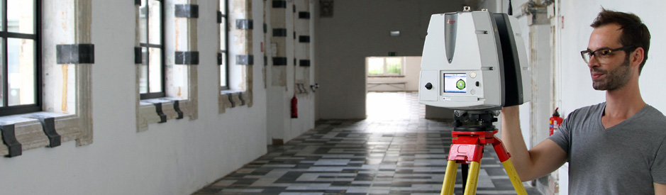
How does a 3D laser scanner work?
A laser scanner is a device that sends light pulses at high
speed under a changing vertical and horizontal angle until the
entire visible surface is covered over 360 °. For each pulse, the
distance between the scanner and the object being measured is
calculated by determining the elapsed time the difference between
outputted and received pulse.
What is a phase scanner? And a pulse scanner?
Both are time-based laser scanners: they measure the time
difference between transmission and reception.
The time measurement of a phase scanner is realized by emitting
a continuously modulated laser beam and by measuring the phase
difference between the transmitted and the received pulse.
A pulse laser beam scanner does not transmit continuously, but
transmits a short laser pulses which is then reflected by the
object. The time between the transmitted pulse and the received
pulse is recorded.
What are the products that you can create with a 3D laser
scanner?
Points Clouds, digital color orthophotos, volume calculations,
models of civilian objects such as bridges and buildings,
animations, views and cross-sections of buildings,…
What is noise?
If someone passes in front of the scanner or if something moves
during scanning this is also recorded. These non-relevant points
are subsequently cleared by the processing software. A phase
scanner also gets more noise as the distance to the object to be
scanned increases.
How long does a 3D laser scan take?
Depending on the type of scanner and the set or requested
resolution it takes 5 minutes to 15 minutes with a phase scanner
and a half hour to an hour with a pulse scanner. For most projects,
the laser scanner is installed in different places to minimize
shadows or occlusions. The larger and more complex the object to be
scanned, the more set-ups are needed.
Is 3D laser scanning more expensive than a traditional
surveying intervention?
This depends on the complexity. For a simple project, the
traditional surveying intervention remains cheaper. In projects
where safety, response time (shutdown of machines), complexity
(pipes, …) plays an important role 3D laser scanning is often the
most suitable technique.
Can you combine scan data with other data?
Certainly. We regularly compare existing 2D and 3D measurements
with scan data. The combination of scan data of 3D laser scanning,
mobile mapping and airborne Lidar is also possible.
Is a scanner dangerous for the people in the surroundings?
No. The laser beam from the scanner is not harmful to the human
eye. Teccon is VCA** certified and makes safety plans for 3D laser
projects.
Why can only be scanned in dry weather conditions?
Raindrops and mist cause ghostpoints and refraction of the laser
beam.
What are ghostpoints?
Ghostpoints are points where an incorrect distance was recorded
during the gathering, which causes the point to appear in the wrong
place in the point cloud. These points are usually removed from the
point cloud.
What is refraction of a laser beam?
The deflection or 'breaking' of the laser beam when it goes from
one transparent medium to the other. In rain or fog it is about the
transition from air to water. Due to the deflection the laser
signal is lost or an incorrect measurement is made.
 3D Laser scanning of the Ezelpoort in Bruges
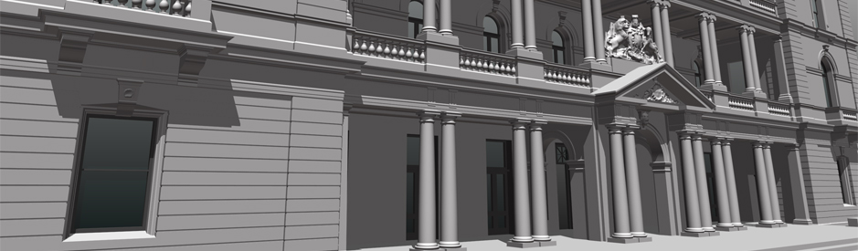 3D model of the customs office in Sydney
 3D Laser scanning off the PALL tunnel
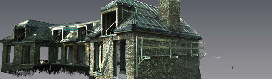 3D Laser scanning of a villa
 3D laserscanning of an historical building


